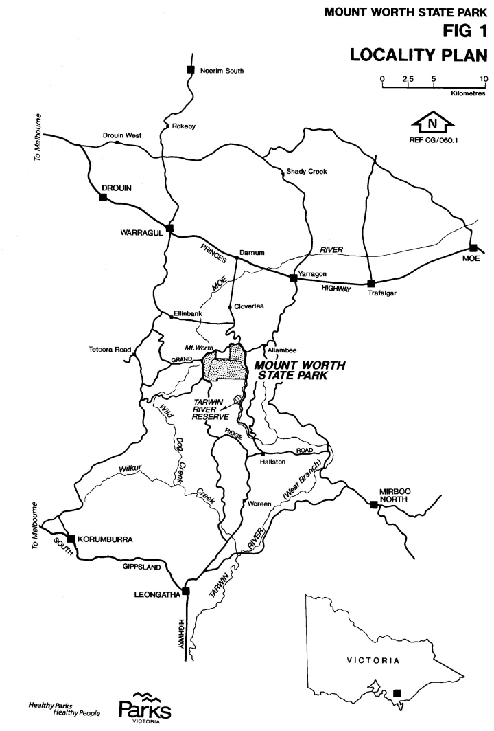
Mt Worth State Park is located approximately 25 km south east of Warragul in West Gippsland and approximately 120km from Melbourne. Although relatively close to busy towns, it feels remote and off the beaten track. Getting there is part of the adventure.
Turn off the Princes Freeway at Darnum and head south for 15km along the Darnum-Allambee Road. The road will take you past the Darnum General Store (last chance to buy food, drinks or petrol), through the green paddocks of Cloverlea and up into the hills.
Unfortunately, it is not well signposted so you will need to stay alert. About 11 km from Darnum, the road turns from bitumen to gravel. When you reach the top of the hill it is worth stopping to admire the view over the valley. Then veer right down the narrow, winding gravel Allambee Estate Road for another 2 km to the Moonlight Creek Picnic Area. It is well worth the effort.
Groups travelling to the Park in large buses have sometimes experienced difficulty negotiating the narrow tight bends in the road. The Friends suggest travelling in minibuses in preference to larger vehicles.
Email Address: mtworthfriends@gmail.com